Karnali Province (Nepali: Karnali Pradesh) is one of the seven federal provinces of Nepal formed by the new constitution which was adopted on 20 September 2015. The total area of the province is 27,984 square kilometres (10,805 sq mi) covering 18.97% of the country, making it the largest province in Nepal. According to the 2011 Nepal census, the population of the province was 1,570,418, making it the least populous province in Nepal. It borders the Tibet Autonomous Region of China to the north, Gandaki Province to the east, Sudurpashchim Province to the west, and Lumbini Province to the south. Birendranagar with a population of 47,914 is both the province’s capital and largest city.
1. Rara Lake
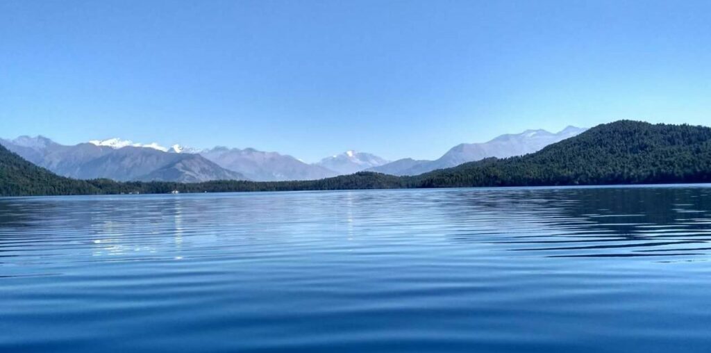
You can either take a flight from Nepalgunj to Talcha airport or take a flight from Surkhet airport to Talcha. You can take a jeep to Rara lake. Yes, you read it correctly. But it’s not a local thing so you might have to reserve it, either from Nepalgunj or Surkhet or Jumla. But the jeep does take you pretty close to the lake, you need to walk for just about 20/25 minutes and you’ll be at the lake. Trekkers must visit this lake. The lake exists in the middle of Rara national park at the altitude of 2990m. People can do recreational activities like boating, horse riding, camping, and sightseeing. Travelers may perform yoga and spiritual activities. The Best season is mars-may and September-December. Bring your hammock and get ready for chilling.
2. Shey Phoksundo National Park
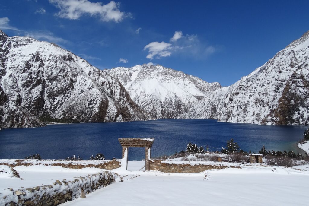
Shey-phoksundo National Park is situated in the Trans-Himalayan region of northwest Nepal. It is Nepal’s largest National Park covering an area of 3,555 km2. It was established in 1984 to preserve a unique Trans-Himalayan ecosystem with a diversity of flora and fauna. The Park’s climatic differences, altitude variations, and different zoo-geographical regions support a diverse range of biotic systems. In 1998, an area of 1349 km2 surrounding the park was declared as buffer zone, which consists of forests and private lands. The buffer zone is jointly managed by the park and local communities. Together they initiate community development activities and manage the natural and cultural resources.
Features: Shey Phoksundo National Park provides a diversity of spectacular landscapes. Elevations in the park range from 2,130m in Ankhe to 6,883m at the summit of Kanjiroba Himal. Much of the park lies north of the Himalayan crest. Nepal’s deepest and second largest lake, Phoksundo Lake, lies in upper regions of Suligad. Near the lake’s outlet is the country’s highest waterfall. The major rivers in the park are the Khung, Nmajung and Panjang, The Suligad and Jugdual Rivers, which are the major tributaries of the Thuli Bheri River; and the Langu Rilver, which drains the high dolpo plateau to the east and flows westward. Phoksundo Lake is famous for its magnificent turquoise color and te spectacular scenery clearly rank it with the most scenic mountain parks in the world. Ringmo village, a typical Tibetan village, is scenically nestled in the area. Many beautiful glaciers can be found near and above the lake area. The Park contain many Gompas (Monasteries) and religious area. The most famous, Shey Gompa was established in the 11th Century. Thashung Gompa located near Phoksundo Lake was built about 900 years ago to conserve wildlife.
3. Sinja Valley
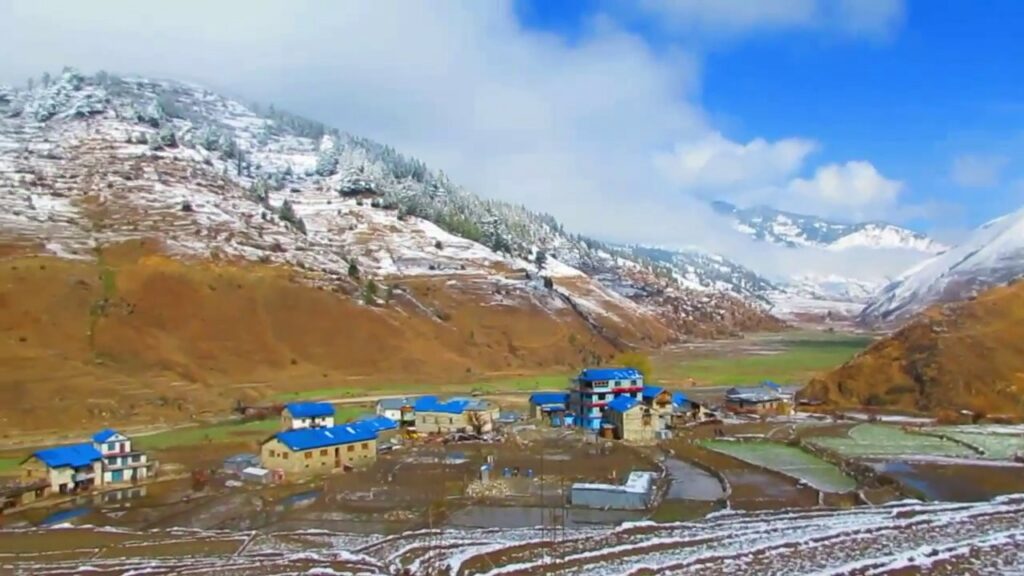
Sinja Valley contains the archaeological evidence of the capital city of the well organized and influential Western Malla or Khasa Kingdom of the 12th and 14th Century. After the 14th Century the Khasa Kingdom split into the Baise or Twenty-Two Kingdoms which existed until the unification of Nepal in the late 18th Century. Excavations have revealed the remains of old palaces, temples (Kanak Sundari, Tripura Sundari) and the old settlement. A remarkable ring of huge monolithic stone columns were found surrounding the ruins of the ancient settlement with a Malla gateway and steps. Earthen pipes were excavated testifying to an elaborate water supply system. Across from the Hima River there are caves with ancient votive Buddhist chaityas and cliff inscriptions. Even today the ancient rites of the Masto (Shamans) are practiced in many of the stone Dewals or temples.
The Sinja Valley was where the Nepali language originates from and the earliest examples of the Devanagari script from the 13th Century were found on the cliffs and in nearby Dullu.
4. Pachal Jharna
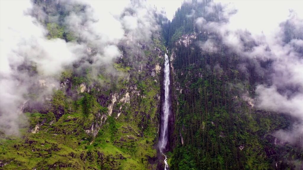
Pachal Jharna in Kalikot district of Karnali province is the pride of Nepal. Pachal Jharna is at the highest point of Nepal i.e. 381 meters. The village municipality is named after this waterfall. Recently, the tourist traffic has also started increasing.
This waterfall is ranked 64th in the list of tourist areas made public by the government of Nepal a few months ago. Located at an altitude of 970 meters above sea level, this waterfall is also considered as a mountain, hard rock, Lekali plain and important religious and tourist site.
Locals say that the number of internal and external tourists has increased recently after the waterfall at the foot of Pung and Chuli Himal was recognized as the tallest waterfall in Nepal. The waterfall, located 26 kilometers northwest of Manma, the headquarters of Calicut, can be reached in about 4 hours by car and on foot.
After a long journey, you will reach to this waterfall , where the scenic beauty and natural beauty will make you forget all the tiredness of the journey. According to the tourists who have come to visit Pachal waterfall from Surkhet, it is not only the waterfalls that cascade down there, but also the view of the towering mountains and beautiful hills that gives a different kind of joy and energy to the tourists. This waterfall was formerly known as Bhutini Chahra by the locals. But recently, Pachal Jharna has started to be established as a natural resource.
5. Karnali River
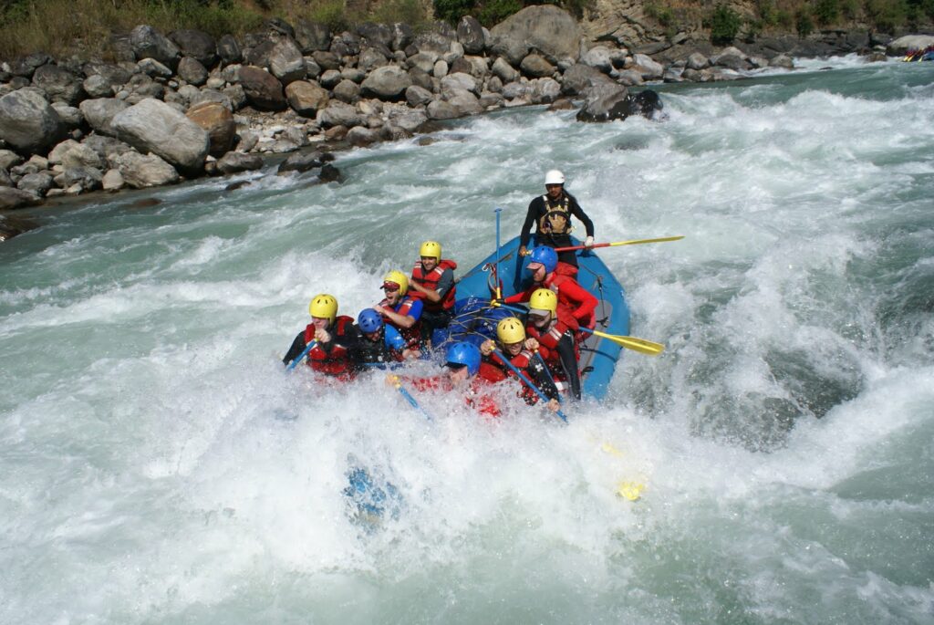
The Karnali rises from Mt. Kailash on the Tibetan Plateau, and flows 671 miles to its confluence with the Ganges River in India. The river provides water for millions of people, provides for fish and wildlife resources and has a high value for ecotourism especially in the form of whitewater rafting and as an approach corridor to the Sacred Mt. Kailash. These ecological services sustain livelihoods throughout the Karanli River Basin. An ancient river, the Karnali was in place as the Himalayan Mountains were thrust up by the collision of the Eurasian and the Indian tectonic plates. As the mountains rose, the river downcut into the landscape, the sinuous channel already in place. Hard rock ledges, ancient and current day landslides create steep stream gradients, boulder strewn reaches and world-class whitewater rapids. Fed by glacial meltwaters and strong monsoon rains, this powerfully erosive river provides water, nutrients and sediments to the lands along its path providing fertile agricultural plains.
For kayaking lovers, Mugu Karnali will be the best kayaking trail for them, if they wish. River with Crystal clear water with deep blue color can attract any sportsman. For kayaking, The water streams of mugu Karnali will be the best to paddle for the kayakers. The renowned kayakers like Ali Marshall, Tom Brown and Pete Scutt have already experienced kayaking from 30 miles lower section of the Mugu from Gamgadi to the Humla confluence. Travelers have to trek up to Gamgadi where they can use potters and Donkey for the heavy materials like boats. In the middle of the way, they can experience the natural beauty and lots of ethnic diversity. So tourists are highly recommended for this type of activities.